Mackinaw City

Leaving Mackinac Island. Fort is in left side of picture, marina below to the right.

Here they spell Mackinaw like it sounds for some reason. After three nights on Mackinac Island we took an easy one hour trip over to Mackinaw City. It’s a pretty small place with not much to do. Paul’s brother Marty had parked their van here before coming over to Mackinac Island on the ferry. Weeks earlier I had targeted this marina as a place to receive packages, so I needed to stop for those as well.

Ship enters one of the two operating American locks at Sault Ste. Marie. Other being repaired in the foreground.

Soon after we tied up we took the van up to Sault Ste. Marie to see the large locks. I could have taken the boat there, but I would go through with large freighters that take a very long time to get in and get out. Even though it is only one very large lock from Lake Huron to Lake Superior the cycle time would have taken up most of the day, and we had no plans to boat on the largest, deepest and roughest of the great lakes.

We’ll see huge locks and be with large ships on the Tenn-Tom. We’ll probably see that sort of thing in and after Chicago also, since there is a lot of commercial traffic there. All the locks in the Erie and Trent-Severn canals took only recreational boats and an occasional small cruise boat specially designed to fit in their smaller locks.

Paul took an evening northeast shot off our bow at Mackinaw City Marina. The marina entrance is ahead to the left.

Standard

Mackinac Island

Lighthouse as we exited calmer waters between Drummond Island and northern Michigan.

Two to three foot waves were predicted in the northwestern part of Lake Huron we would go through to get from Drummond Island to Mackinac Island. None of that was noticeable as we left since we were protected between Drummond Island and northern Michigan mainland. After about 15 miles we got into northwestern Lake Huron and turned west. Then things got just a little bit rougher. Since winds were from the northwest I hoped that hugging the south coast of northern Michigan would protect us and I think it did.

There was no significant rocking until we struck out in a southwest direction to get to Mackinac Island. I need to look at a latch for the refrigerator doors, because a few times they wanted to open and deposit their contents on the floor. Sue and Sharon managed to prevent that while Paul and I swayed with the waves up topside. Waves on the beam (from the side) are the worst and that was how we were taking them, rocking from side to side. That lasted less than an hour and we entered the Mackinac Island marina behind the breakwaters.

The fort is across the street from the marina. First thing Sue wanted was a carriage ride through town.

Even if the waves on the beam are not so high, if they come with the right timing they still can get you rocking. We plan to have stabilizer fins installed early next year which should almost completely eliminate the side to side rocking we had today. The only thing I can do now to make the boat a little more stable is to make sure the water tank and fuel tanks, which are stored low, are full. The fuel takes awhile to go down, but with four people on the boat we top off the water every couple of days or after Sue runs a few loads through the washing machine.

Main Street here reminds us of Main Street USA in Disneyland, except for the horses and bicycles.

At Yankee Rebel Tavern. We also allowed ourselves one elegant (and good) meal at Woods Restaurant.

We travelled less than 50 miles, were there well before noon and went to lunch at the Pink Pony restaurant on main street. Later Paul’s brother Marty and his wife Cheryl showed up and got settled in.

We’ll be here three nights, which should give us time to see a lot of the island, since it’s not very big.

Standard

Back to the US

Didn’t see a lot on our trip west. This and two or three sailboats in the distance.

After a down day in Gore Bay ON we left early and went 60 miles west to Drummond Island. We woke to a light rain which became heavier by 7 AM when we pulled out of the marina. Most of the trip was open water, the temperature was not cold at all, and best of all the wind was going our speed in our direction. That did kick up some reasonable westward waves which grew as we went in their direction, but they traveled nearly our speed so we hardly noticed them. The rain was off and on as different fronts moved eastward over us. Apparently the upper air went east and the lower west because our tailwind lasted the entire trip.

We picked up a little over a mile per hour speed from a current going our direction also. I wondered there could be a current in the great lakes. The overall flow of water there is east to the Atlantic, but that is not noticeable in the great lakes. I did learn that wind driven tides can be as high as six feet at the east and west ends of some of the lakes. Quite a lot of water would have to flow to accomplish that. That must have been what we saw.

The chief draw of the North Channel seems to be great anchorages in the middle of nowhere. We’d already been in the middle of nowhere a lot, and it was great, but it was time to move on. We have a three night reservation at Mackinac Island Marina starting tomorrow. Mackinac Island is a popular vacation spot with a short season, and people reserve places at the marina months in advance. We can’t plan ahead like that, but still managed to secure our three nights just last week. It probably helped that they were all weeknights.

Paul took this of us and Star Gazer at Drummond

We travelled open water although in sight of the north shores of Manatoulin, Cockburn and finally Drummond islands. I played with the radar to see how easily it could find boats around us. The rain decreased its range, but decreased our seeing range even more. Paul spotted most boats before I did. I noticed a boat on the radar well before I could spot it, and whenever Paul saw one I looked at the radar and there it was. A boat that is a barely visible speck is a pretty noticeable spot on the radar. So far we’ve needed the radar only once, but it’s nice to have.

We arrived at Drummond Island Yacht Haven about 2 PM and pulled up to the fuel dock. When you first enter the US you stay on the boat until the border control agent comes. She came up the back steps and had me fill out a form, looked at our passports and then went quickly through the boat, just looking into each room. I paid a small fee for a sticker and that was it.

We’ve heard a lot about Mackinac Island. Paul and Sharon have been there. We’ll meet Marty and Cheryl, Paul’s brother and sister in law there as well. They’ll be tourists with us on the island and then travel a few days with us down the Michigan coast.

Standard

Manitoulin Island and Gore Bay

Yet another sunrise picture. We have better, but this is the best for Friday morning as we left Killarney

There had to be one more bridge. Yesterday we entered the North Channel at the north of Lake Huron which is divided from it by Manitoulin Island. This island is 75 miles long and at its east end has the only bridge connecting it to the mainland to the north. It’s a swing bridge that opens every hour.

We left Roque’s marina at Killarney at 6 AM and covered the 20 miles to the bridge slower than I anticipated. We ended up waiting awhile in open water a mile before the bridge. Usually we have to wait in a small channel, possibly with a current, which requires constant attention to keep the boat away from shore and in a reasonable position. This time I just turned off the engines and read a book.

The town of Little Current on Manitoulin Island, just west of the swing bridge.

At 9:00 the bridge opened and we passed the town of Little Current just beyond it. It wasn’t very big, but I think it might be the largest on the island. We took this trip slow, moving quietly westward about 300 feet off Manitoulin’s north shore.

We finally turned south into Gore Bay and arrived at the marina at it’s end. Several looper boats traveling our way were already there when we pulled in and some of them came over to catch our lines and help tie up.

We stayed an extra day and will leave Monday. There is not a lot to do, but there is a small downtown with a grocery store that almost makes supermarket status. Several second hand stores also caught Sue’s notice.

GoreFalls

This is the big attraction the area, Angel Falls just outside of Kagawong. Today is Sunday so people are out.

I dropped the motorbike and rode to a Kagawong 10 miles west. This was smaller than Gore Bay but did have some nice touristy stores, a marina and a museum. I spent a half hour in the museum learning a bit of local lore and then went a mile up the road to Angel Falls. The falls were not spectacular, but maybe could be in the Spring or after a lot of rain. This is where the locals come on Sunday. There is a nice pool at the bottom of the falls where the children play with the falls raining down on them. There were plenty of kids catching things in the stream that flows out of the pool and out to the North Channel at the town.

GoreBay

Gore Bay Marina left of center. Town of Gore Bay to its left. Star Gazer on outside dock just left of sailboat mast.

Tomorrow we leave for Drummond Island which is just across the US border. We’ll check in with US customs there. I think that may be more than just a phone call.

Standard

Beaverstone Bay and the Collins Inlet

In the Collins Inlet, just past Beaverstone Bay.

Georgian Bay is not known for its interesting towns and ports or for fine restaurants along the way. The big thing here is the scenery among the thirty thousand islands. Today was the best scenery of all.

We got up early, pushed our stern out to avoid the houseboat right behind, and backed out of Wright’s marina. There was no wind, so it was easy.

An hour or so after we started. Just stay right of the greens and left of the reds.

At the mouth of Byng Inlet we found a red line on the chart we could pick up and headed out. It led out to open bay in some places and behind various islands in others as we worked toward our goal that day of the top of the bay at Killarney.

We saw several of these in Beaverstone Bay and in Collins Inlet.

About the halfway point the red line turns and plunges into Beaverstone Bay. Five miles in at the back of the bay starts a narrow channel called Collins Inlet that continues on more than twelve miles before it comes back out into the main Georgian Bay. This was the prettiest waterway we have seen in Canada. Narrow enough to be up close and personal with the rock formations and trees on each side, but wide enough to pass an oncoming boat without major issues arising, although passing a boat going the same way would not work.

Collins Inlet

We took it slow and quiet through here. The weather that had been pretty nice but a little cool, warmed up so Sue and Sharon had their chairs out on the bow. It’s great seeing parts of the US and Canada we have never seen before, and most of it is not at all like we expected it to be, and most is better than we thought it would be.

Less than a half hour after exiting Collins Inlet we entered the channel that cuts off George Island from the mainland to the north. We stopped at Roque’s, the last of the three marinas on the channel in Killarney.

Standard

A Better Bay Day

Rocks everywhere, both sides. Hopefully not right in front.

Today was supposed to be better weather so we left the Parry Sound dock at 6 AM, continuing on our “inside northern” passage of the Georgian Bay. Like yesterday, nearly all the time we were in “inland” protected waters, separated from the main bay by many islands large and small.

Morning was still cool, but not enough to go downstairs. Later on the sun came out and everyone was up top as we passed various shores and islands. Most islands that have a house have only one. A great way to vacation if you want isolation. No cars out here. No bridges except for the one we waited on yesterday. The nearest thing they could have to a road would be a footpath, and we’ve seen none of those.

More winding paths and hairpin turns. We go a mile or two out into the main bay, make a 160 degree turn around a marker and head back in. The long thin stone fingers we avoid are sometimes visible and sometimes invisible just under the water. Locals say the water in the bay (Lake Huron) is two to three feet higher this year. That should make passage easier, but many formerly visible patches of rock are now just underwater. Sticking to the chart we should be OK, but go somewhere else and no telling what we could run into.

We’re in, behind a boat of similar make, but can we get out in the morning?

Tonight we’re at Wrights Marina in Byng inlet. I think there’s a town called that also, but I’m not sure. Apparently there was a British admiral Byng who lost an encounter with the French in this area and got executed for it.

It was pretty windy off our beam as we went in between docks to tie up. I tried to back in, but too much wind blew me to the side, so I went bow in. Backing in with a crosswind must be done fast and decisively, which I can’t do when I can’t see out the back. No room to turn around, so we’ll have to back out when we leave in the morning. No one will be on the dock to help like they were when we came in, so there’d better be no wind in the morning.

Standard

Parry Sound

Town docks and marinas. Downtown is to the right of this picture.

It was time to change the oil, filters and fuel filters, and Sound Boat Works just across from where we were staying had all the parts, so we went over there and had that done. We spent the rest of the day in Parry Sound, the town.

Parry Sound has about 17,000 people, although much of the surrounding area also uses its stores and schools. It has a nice main street. Our last three stops have been Orillia, Midland and Parry Sound. In Orillia, near Lake Simcoe, the downtown was pretty nice even though a Walmart had opened up at the other end of the main street. The downtown in Midland had a lot of closed stores and did not look very lively, which locals put to the new Walmart there. No Walmart in Parry Sound yet, and the downtown was maybe the best of the three.

An old downtown in a sea of trees. This is a nice place.

Sue and Sharon spent afternoons on Tuesday and Wednesday downtown. On Wednesday Paul and I hiked up to a tower on a nearby hill. There’s a museum there as well, but we were a little late for that. We did climb the stairs up the tower to look at the bay and the city. Parry Sound is the nicest looking small town from above. Most of what is visible in any direction is trees. The largest patch of town in the trees is the old downtown. A smaller patch of Uptown (my designation) at the other end of the main street is also visible. The residential part, assuming it exists, is nearly all hidden beneath the forest.

Downtown Parry Sound looking back toward the bay. Note the railroad bridge.

Winter does come in pretty strong here. All boats move away or are out of the water as the lake freezes about a foot and a half deep. Then they have snowmobile races and other things you can do on a large expanse of ice.

The big railroad bridge built in 1907 is a big part of the scenery here, and nearly any painting or picture of the town I’ve seen seems to have it in the background. Several trains come across it every day.

Light rain this morning. Better weather predicted for tomorrow. We’ll be off at 6 to see more of the bay.

Standard

Day for a Hardy Seaperson

Many islands ahead Hope the chart is correct about which two to go between.

I have all sorts off weather apps and websites. Some of them really show me whether a storm will hit or pass in the next hour or so, but as far as what will happen tomorrow I have pretty much failed. Keith and Gayle thought they had it figured out when they assumed the opposite of what I said. That did work for awhile, but also proved unreliable.

Anyway, with all my weather knowledge I decided we would leave today on the first leg of our trip through the north edge of Georgian Bay. We’re in the “Canadian shield”, which is made up of a lot of granite. We see a lot that was scraped clean by glaciers and other parts where some soil accumulated to grow trees and such. There are 30,000 islands in the bay and we wound through quite a few of them.

We’d pass between islands like this with considerably less than a boat length between us.

Our charts have a red line showing the path through this maze of islands, sometimes taking us in channels with granite rock out of the water on either side within 30 feet. Often we have to slow down, sometimes to idle speed, to negotiate turns and stay away from those rock islands.

Some of our trip wound through relatively calm channels, and other times we were exposed to the main body of water with 2 ½ foot waves and 20 mph winds. Paul and I started out at 5:45 AM with Sue and Sharon still in bed. They stayed even when we told them they should be up with us, because if we hit one of those granite islands we would probably sink, and their chances might be better up on deck.

The first few hours of the day were cool and windy, and Paul and I decided to move down and drive from below. We did put our new wipers through their paces since the waves and wind threw a lot of water across the salon windshield.

It warmed up a bit, so after the ladies used a calmer spell while we were behind overlapping islands to get hot coffee and some breakfast for us, we returned topside. Sue and Sharon watched the action from the salon as we passed between and around island after island. Sometimes a channel appeared to take us inland, meaning between a larger island group and the real inland.

Parry Island protects Parry Sound from the main bay waves and weather. It is quite large and has its own bridge.

Finally we went through a number of channels making our way to Parry Sound, said to be the deepest natural freshwater port in the world. I had not counted on any more drawbridges until we reach Chicago, but we ended up waiting half an hour just a mile from our destination for a swing road bridge that opens on an hourly schedule. We reached Parry Sound Town Docks about 12:30 and tied up to the concrete wall.

We’re out at the end of the Parry Sound town pier (they call it a dock). Main street starts a block beyond this pier.

With all the wind and waves on our trip, at least it didn’t rain, but that started once we tied up. The rain did lift later, and we went out to see some of the downtown area and try out a restaurant.

Standard

End of the Trent-Severn

High point of the day. Rail carriage crosses the road one turn before taking us across.

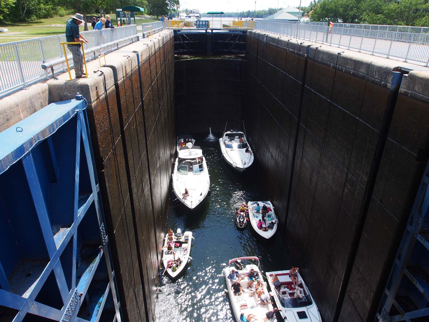
Our last day on the canal, between Lake Simcoe and the Georgian Bay, was maybe our most active. At Orillia we were told this would be the busiest part of the canal system. At Bobcaygeon they told us that was the busiest part, so I’ll just say that today we travelled a busy part. Today, Saturday, was the first day of a three day holiday weekend. The weather was pretty good, which meant a whole lot of boaters were out. Our first lock, 42, opened at 9 and was about an hour away. There would probably be a lot of boaters parked overnight on the blue line that would want to go through first, so we left at 8:30 hoping to make the 2nd or 3rd batch. When we got there the lock appeared full, but the green light remained on, so we squeezed into the last slot, beside a narrower boat. We two back boats were each just a few feet from the back gate.

How did they know? The green light stayed on so in we went. Just a few feet to spare side and rear.

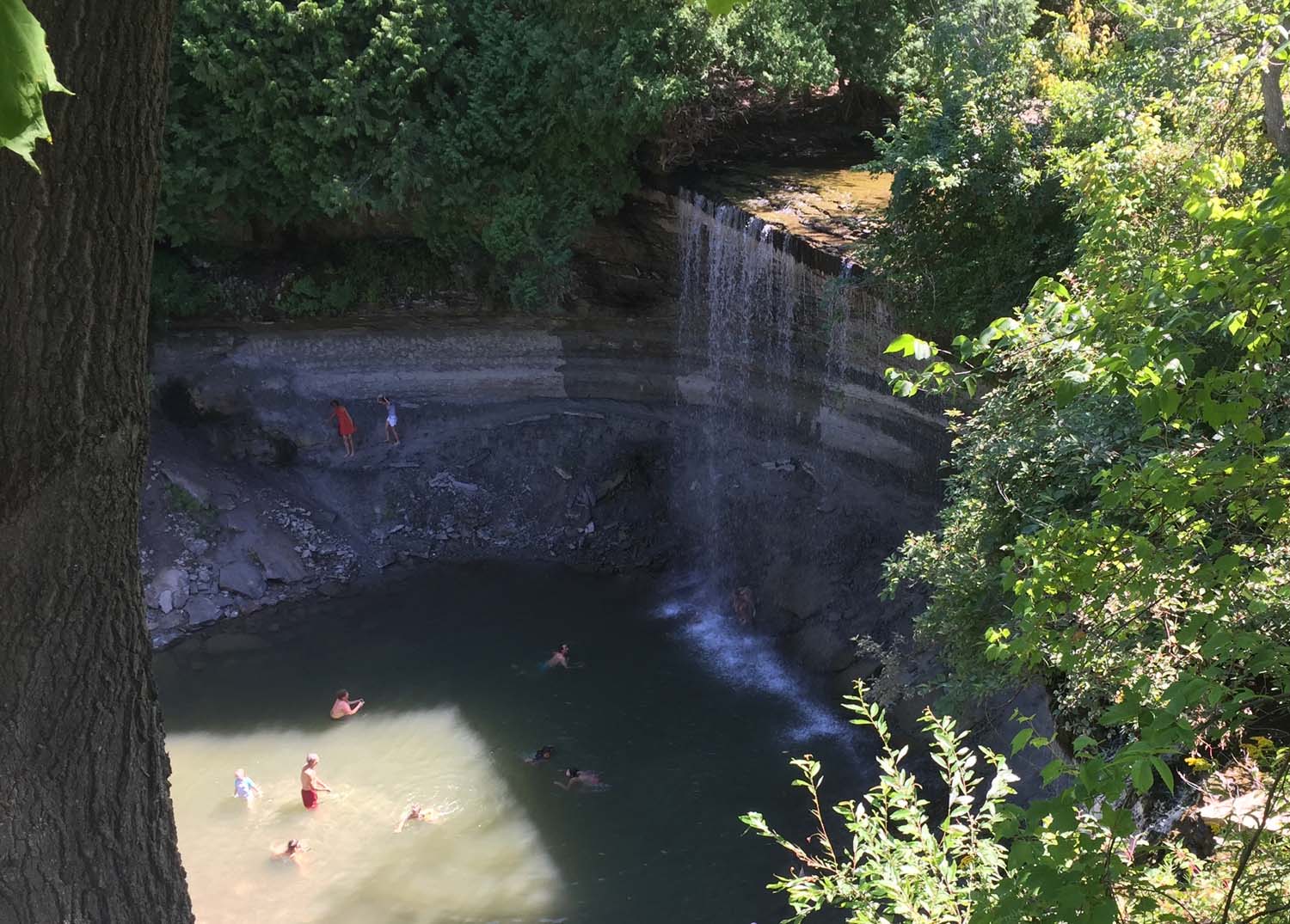
Fourteen miles later we were surprised that lock 43, Swift Rapids, is the deepest standard lock on the system with a 47 foot drop. It was just finishing locking down a group of boats when we got there, so we had a few minutes to get out for pictures.

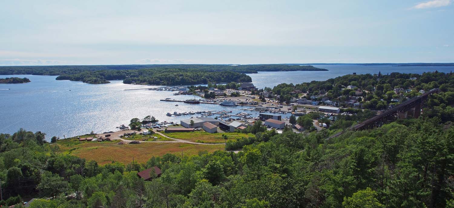
About an hour later we got to lock 44, the famous Big Chute marine railway. The blue line was full up, with some boats rafted 3 across when we arrived, so we just floated off the wall and waited. When they could take the next group, the boats on the wall move up in the line, and just enough space for us and an additional runabout opened up in back. It took about an hour and a half while we took pictures and moved our boat up in the line along the wall each time they took another group on the rail carriage.

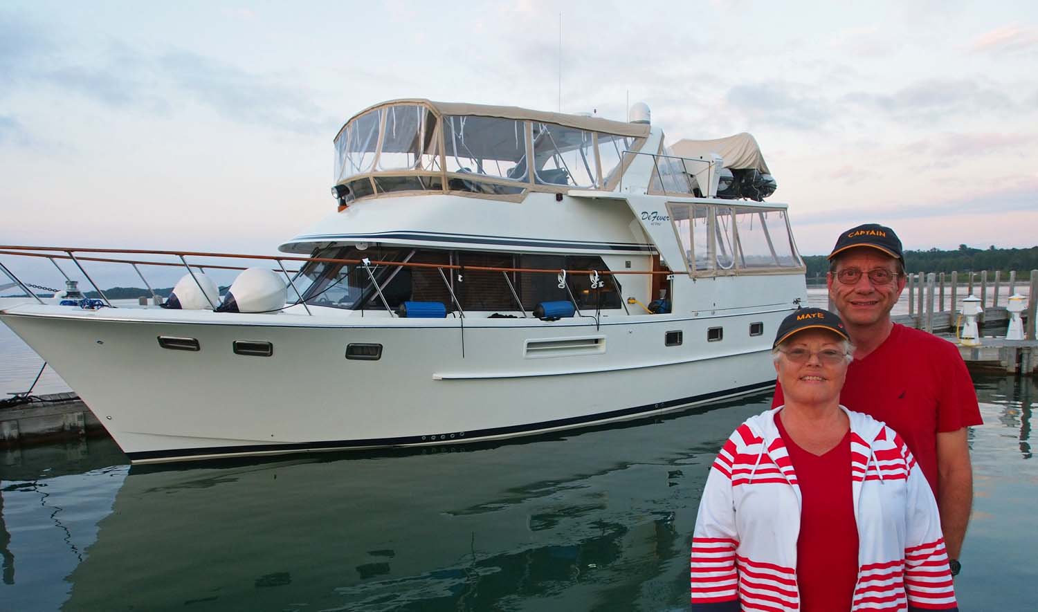
Finally our turn came. Two small runabouts went on first, then we took up the rest of the carriage. Most boats are suspended on straps, but they asked me if they could just use the straps to balance us and set us on our keel. Thinking about how hard we’ve hit that keel running aground, I told them that would be no problem.

We’re standing 50 feet above the water down there. Star Gazer waits above on the wall to the left.

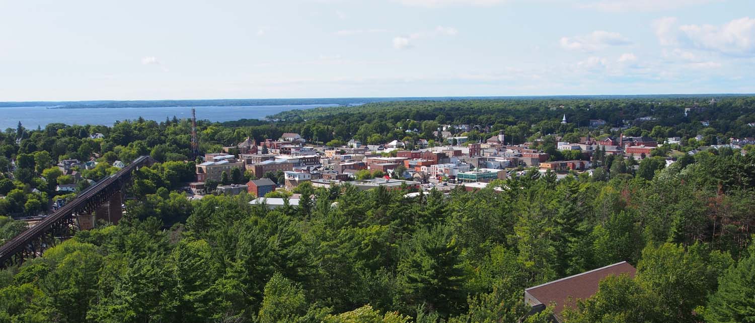
The carriage took us up out of the water, across a road and then down the hill for an overall drop of 60 feet. We stood up on the bow, looking down the hill for quite a ride. On exiting Big Chute, a Securite call was immediately made to warn oncoming boats of our impending passage through the narrow fast current Little Chute channel. With the strong following current we could not stop for an oncoming boat. There was no answer so we passed without incident and soon came to the last lock in the system, the rather normal lock 45.

We sailed right into lock 45, got down to Lake Huron – Georgian Bay level, and headed though the last of the channel to the bay. We quickly neared another choke point, the highway 400 bridge (these points are called out on Active Captain and often by signs along the way as well). Before I could make my Securite call I heard one from a cruiser coming upstream. I answered that we were also close to the bridge and were moving with the current. The other captain quickly answered and said he would stand down until we passed him, and we later exchanged greetings as we passed the spot where he waited.

Doors open on Swift Water lock 43. We dropped 47 feet.

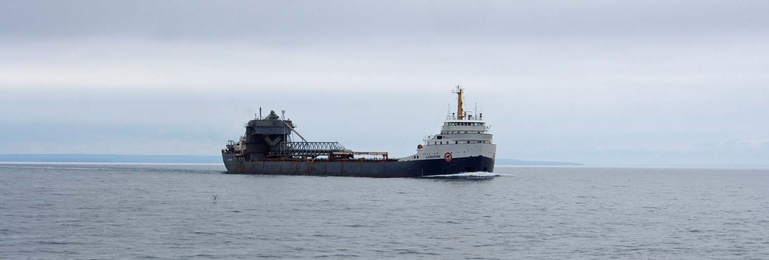
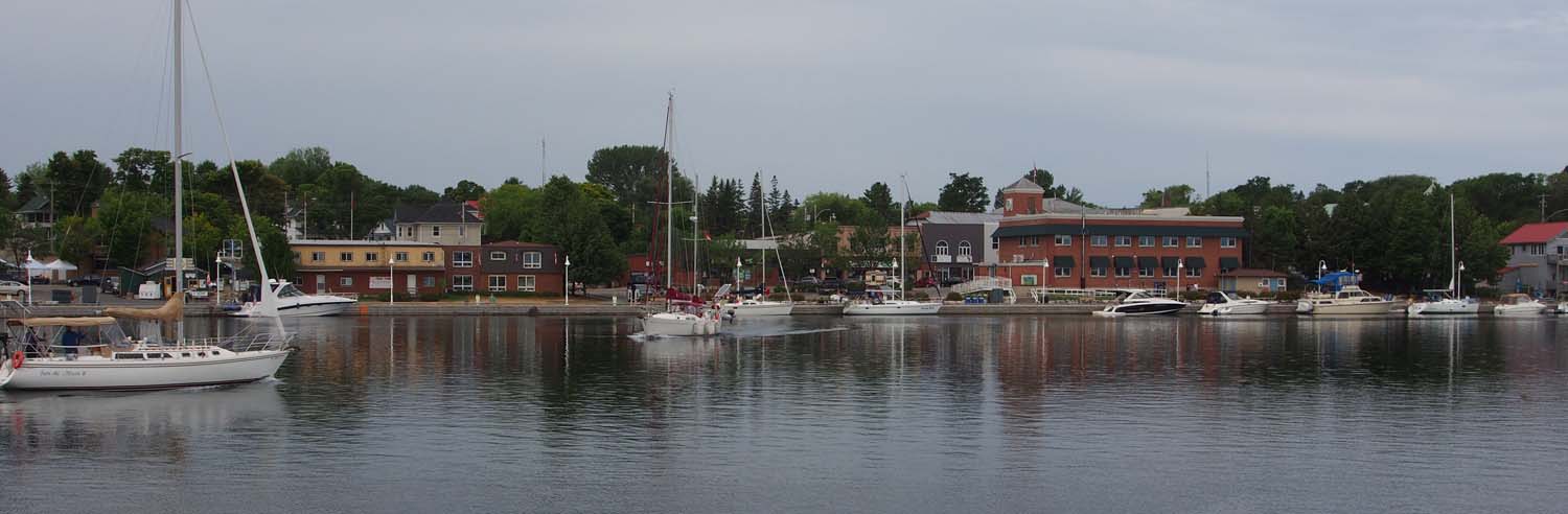
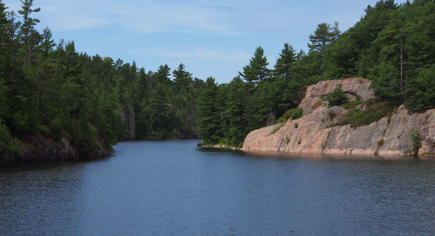
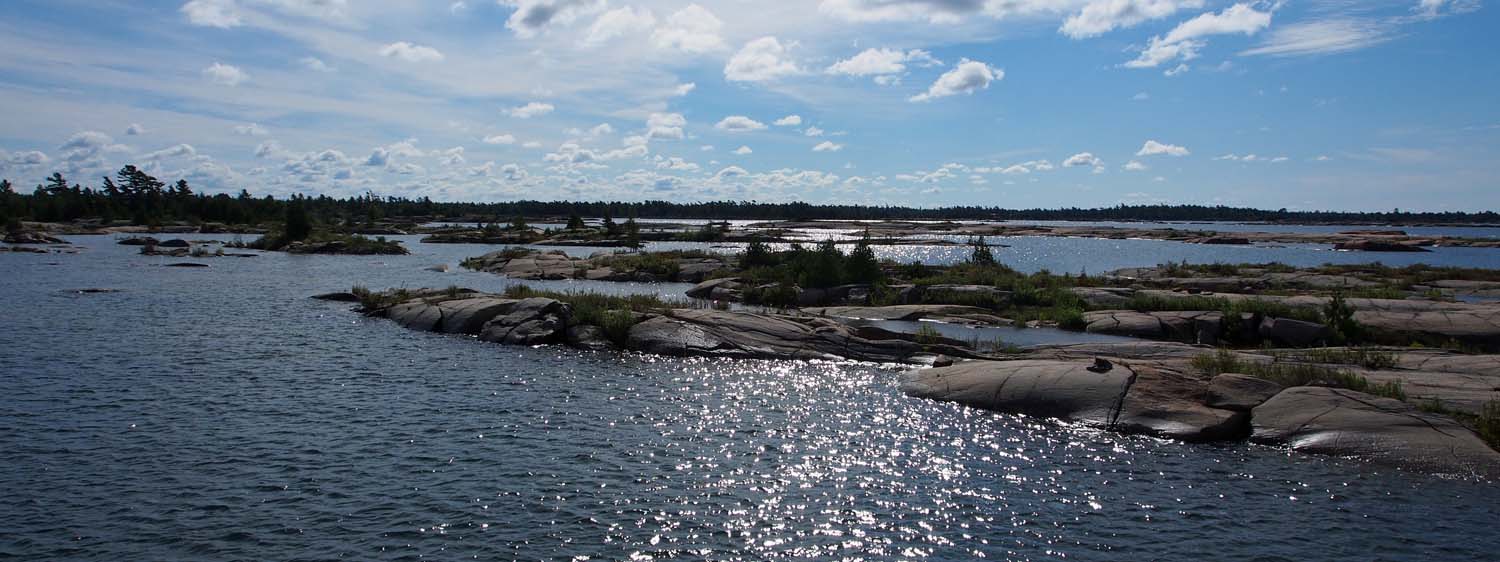
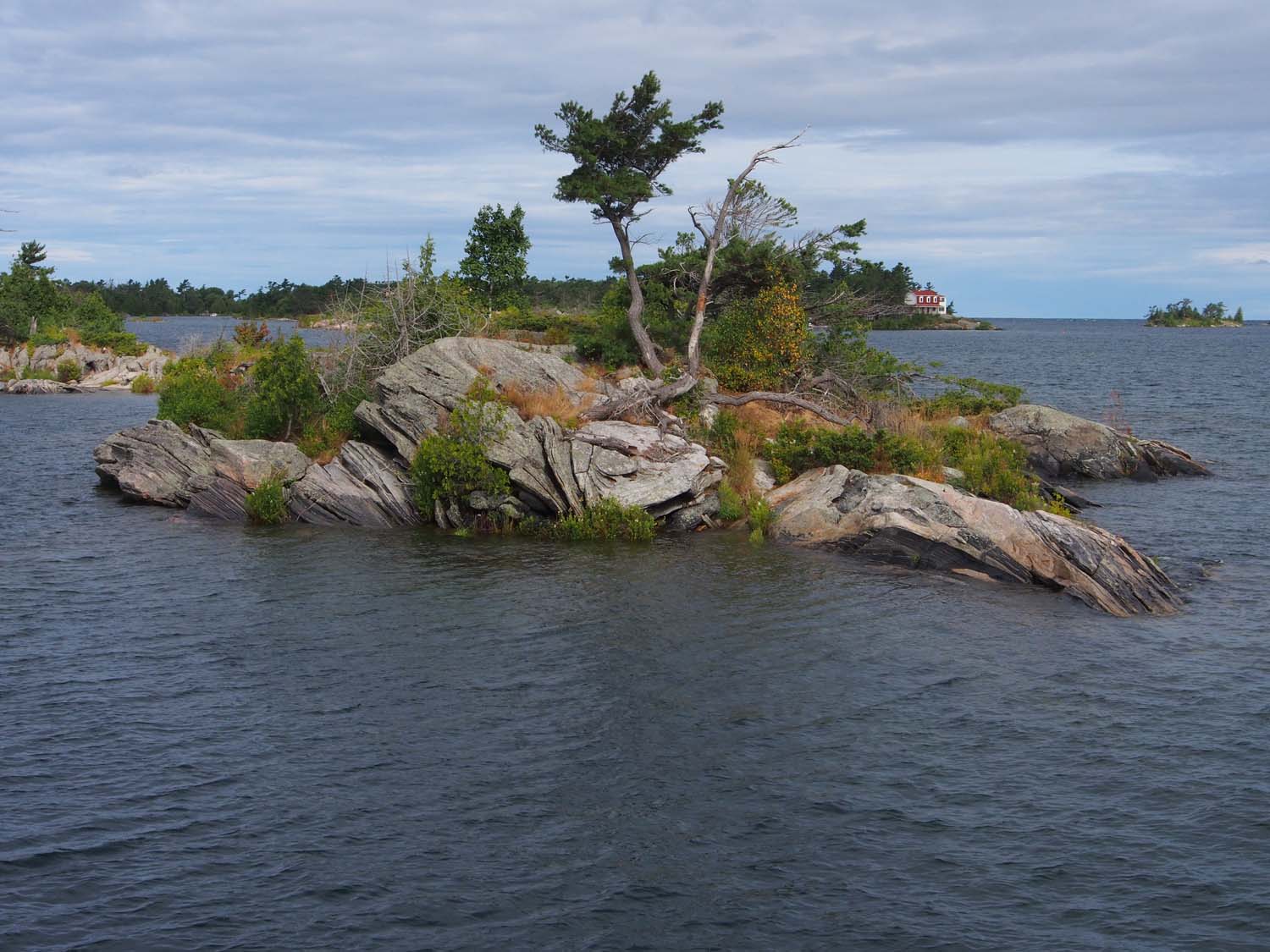
That was it. We had finished the Trent-Severn canal and were out into the Georgian Bay. Into a lot of wind, that is. The wind had set up some waves that did not seem that high until we passed one of those small bass boats with the a big outboard motor like we often see fishing on calmer waters. He was going our way but this was one occasion we could go faster than him. He was flopping through the waves with his nose rising almost vertical sometimes. Looking down at that the waves suddenly seemed a lot higher. We found later they were about 2 feet, with winds about 25 gusting to 30. Not bass boat weather, I guess. After 5 miles of that we reached Midland Town Docks at 6 PM. We had put in a long but interesting day.

Standard

Locking Videos

Lots of good internet access here at Port of Orillia marina, so I have done some blog posts and can add this one with videos Paul took of Star Gazer going through some locks on the Trent-Severn canal system.

Here is a video of the view from the restaurant where we ate lunch in Fenelon Falls. We are just below the dam and powerhouse. The canal and locks are beyond the powerhouse in a separate channel not visible here.

We are dropping 59 feet in the Kirkfield lift lock, lock 36. Then a look back as we exit the Kirkfield lock.

Here is a view from the bridge as we enter lock 38, where we had just stayed overnight.

Here we are entering lock 39, then you see water draining from the lower lock gates. With the lock drained the gates are being opened manually. You can see the attendant in the upper left corner opening the gate on his side. Finally we leave lock 39.

Standard