
Looking west into our anchorage lake just before we left.
I got up at first light Saturday morning and noticed Reunion just going out into the channel. We were in no hurry and took more than another hour to get going. We would later meet Reunion in Mobile bay as we neared our marina.
Our second anchor, though much smaller than our main, held like a champ. I don’t think the boat moved more than a few inches in any direction all night. Having no wind or current helped that, of course. It held so well that when we backed off the main anchor to get the swim platform right over it I could not pull it up. Finally I got the chain as tight as possible and held it bent over the swim platform corner and bumped the boat a few feet backward. That finally released it. Earlier I was thinking of getting a larger stern anchor, since I could handle a heavier one that what we have. Now I think I’ll stick we what we have. Anything harder to get out may end up being left behind.
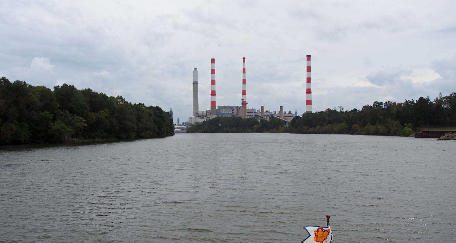
The last of a number of power plants we passed. I think most are coal fired and use barges to deliver the coal.
The trip was uneventful and the weather good if not outstanding. It got a bit windier when we reached Mobile Bay, but no significant waves. While the city of Mobile is not impressive from the river with few big buildings visible, the amount of river industry maybe exceeds the Norfolk area if you subtract the naval presence there. This ranks up with Norfolk and Cal Sag as the three big industrial areas we passed through on the loop.
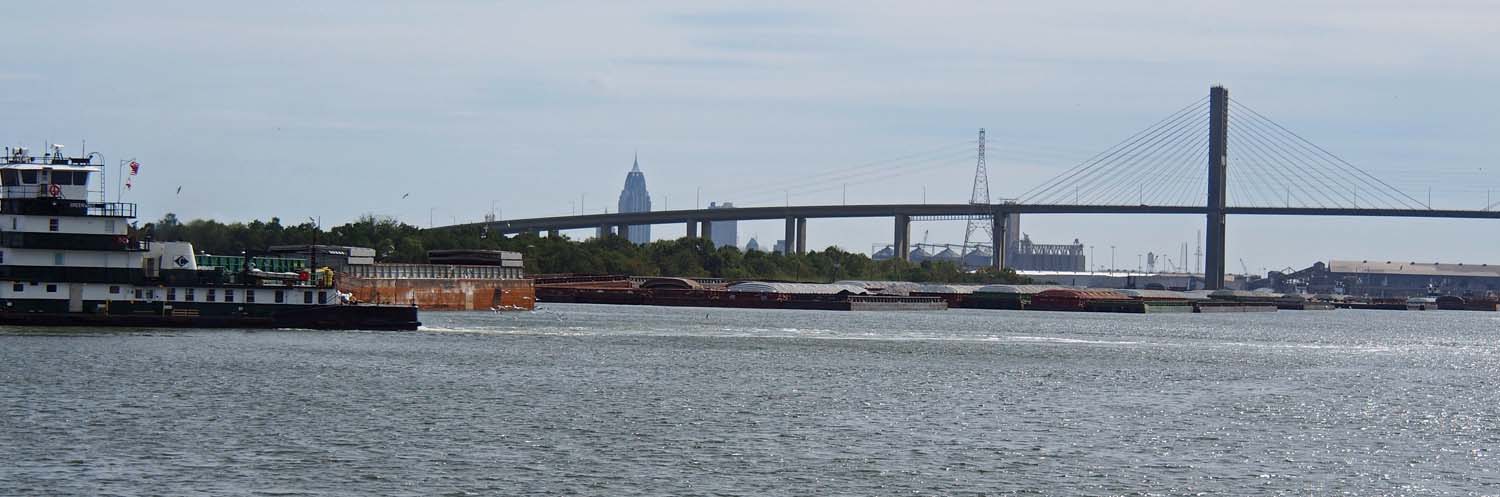
The outskirts of Mobil. Passed may docked barges and a lot of tow boats.
We entered the shipping channel in the bay right after passing through Mobile and the industrial part of the river. Early on we passed a dredge. I wish I had taken a picture of that dredge, since we had a lot of trouble with it. We continued due south on the channel for 4 miles to marker 72.
Reunion, who I had just caught up with, followed by us, turned 90 degrees left at marker 72, following the instructions to get to our marina on the east side of the bay. As we turned the dredge called me and told me to STOP and asked the name of the boat ahead (Reunion did not have AIS) and then called them and told them to turn around and go back. Turns out the dredge spoils (output) line extended 6 miles south of the dredge along the left (east) side of the shipping channel clear to marker 68. He especially yelled at Reunion, which had gotten a fair ways to the east before stopping. He claimed his lines were marked, but neither of us ever saw anything to the left of the channel. There were some very small white markers way out to the east, but they just looked like a few small pipes a few inches in diameter sticking up a few feet. How were we supposed to know they indicate dredge spoils conduits just below the surface?
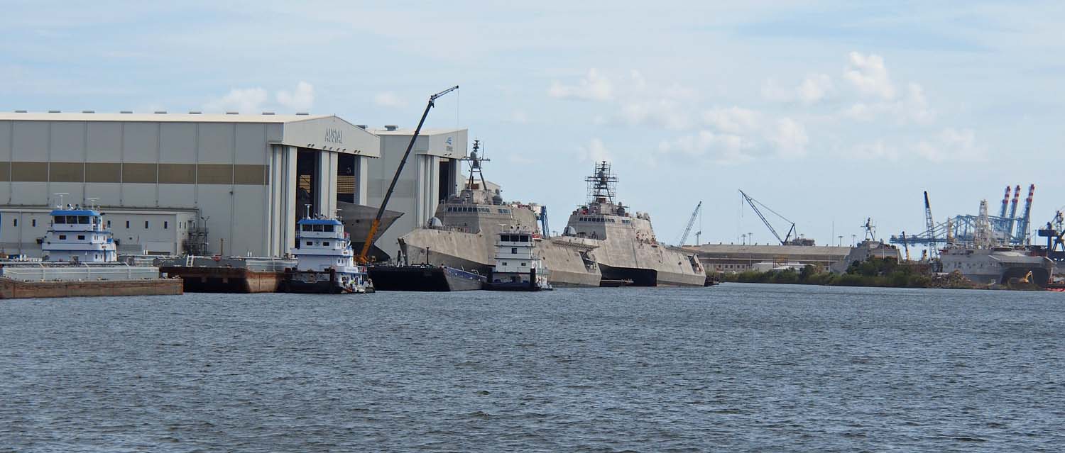
No naval presence here like in Norfolk, but there is a company building these things. They’re not fishing boats.
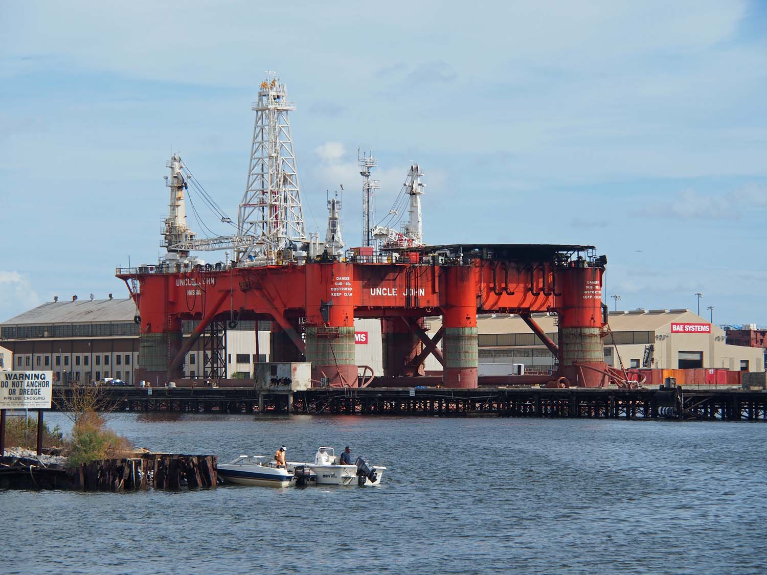
Looks like an offshore oil platform. Saw only this one.
Anyway, neither of us hit anything. But how to get to the marina? The charts indicated spoils from previous dredging dumped all along the east side of the channel, so we couldn’t just plow through there. The dredge guy said to go down past marker 68 and then turn left. When questioned he had no idea if that was a safe route. His spoils lines stretched to marker 68 and he just did not want us going over them (I assume we did not want to go over them either). Anyway, we consulted the chart on the iPad and decided there was a gap in the spoil area a little further down and turned east there. We were able to cover the 7 miles to the east side of the bay and our marina without further emergencies.
Eastern Shore Marina is a bit old and funky, but they parked us under cover, which might be handy when we get outliers from that big Mexican hurricane the next few days.
