Atlantic ICW: Completing the Loop

OLYMPUS DIGITAL CAMERA

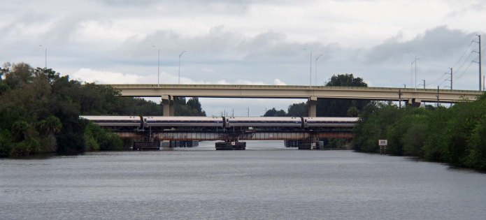
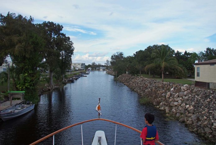
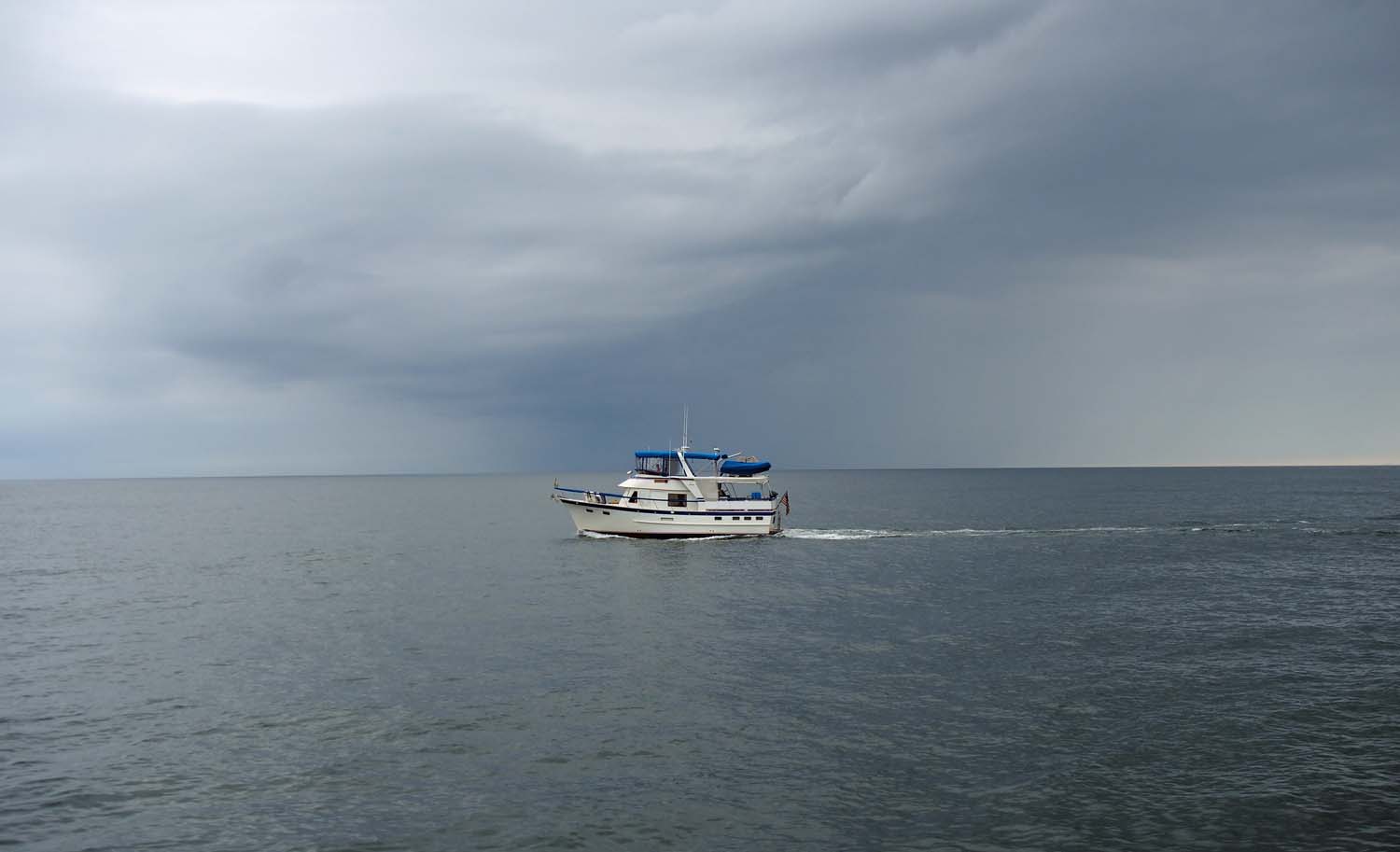
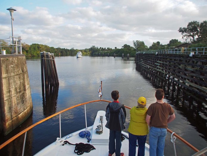
Leaving the St. Lucie Lock. Will reach Atlantic ICW in 20 miles.

Around 7 we idled out of our marina and continued East. In about a mile we hit the St Lucie lock. The second lock down and the last of the 5 Okeechobee Waterway locks. In less than 20 miles we reached the Atlantic ICW and crossed our path from March earlier this year, completing the great loop. We continued 42 miles south on the Atlantic ICW to stay again at Loggerhead Lantana Marina, where we stayed 4 months last year. This time it was just for a night.

OLYMPUS DIGITAL CAMERA

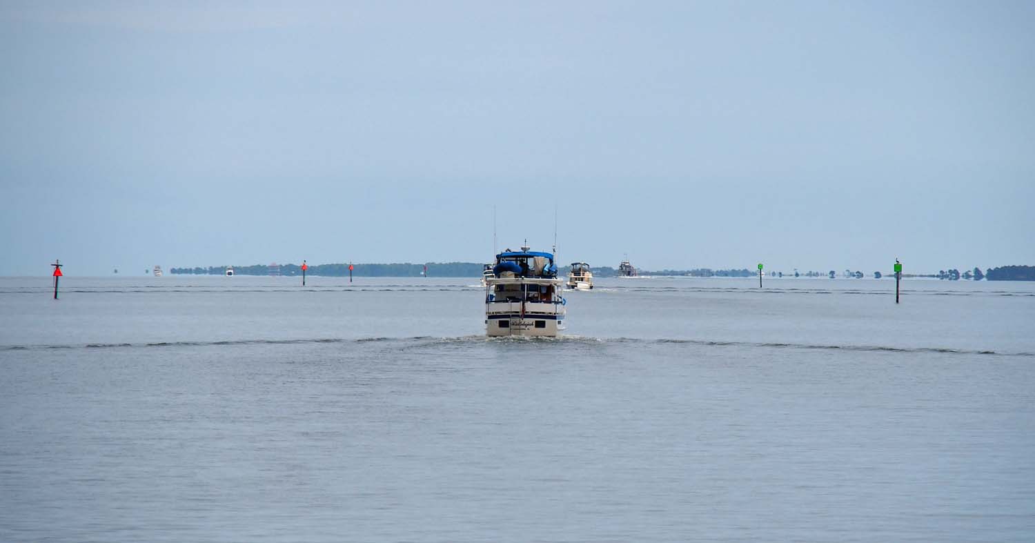
Near Port St. Lucie. We moored one night in this field about 2 years ago.

The wind was up for our more than 40 miles along the Atlantic ICW. Last winter when we stayed 4 months in Lantana we had many windy nights while safely tied up. I used to think how awful it would be if we had to take the boat out, or worse, dock it in that weather. Tonight we got our chance. The wind was over 25 mph and gusting 30 as we came in to tie up. Fortunately we just had to come along a T head. Backing into a slip would not have worked in those conditions.

Star Gazer catches many times as much wind as a sailboat with its sails down would. The wind would have from 45 degrees off our starboard bow if I had come in parallel to the dock as I should have. Then I would just hold the boat’s direction as well as keep driving forward to counteract the headwind and we would have been blown sideways with our port side going nicely to the dock. Instead I forgot and just approached as I normally would, toward the dock at a 45 degree angle. I would turn parallel to the dock just as the nose got very close.

OLYMPUS DIGITAL CAMERA

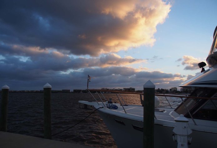
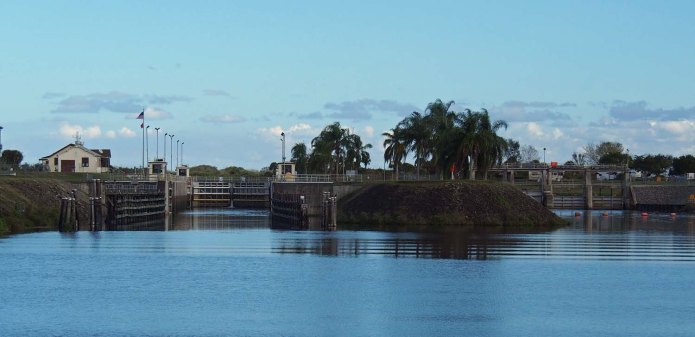
Tied up in Lantana. Wind has died down. Hope for better weather to the south.

I had never docked in this kind of wind before, however, and as I got close the wind was hitting us full on our starboard side and I could not turn the nose into it. I finally did turn it some, but we were being pushed mightily into the dock and the port bow area hit the pilings, resulting in two dents at the top of the hull. The fiberglass needs minor repairs and we’ll have to replace a few feet of the rounded stainless trim. Still, we did the entire great loop without such a mishap and we have to dent things up docking on the very last day!

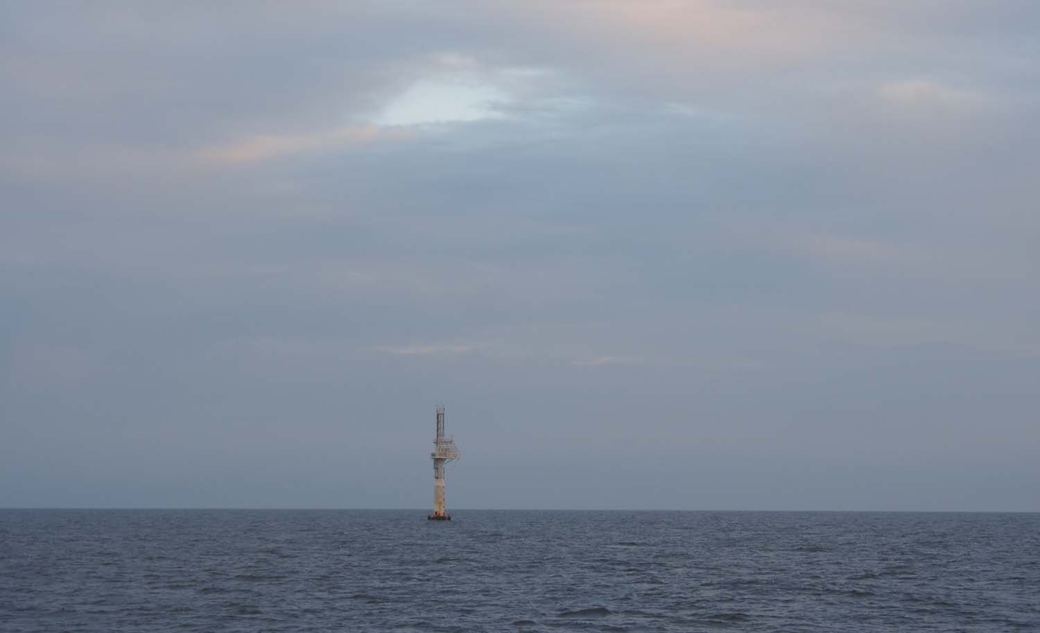
I wonder if there is something that makes it especially windy right here. I don’t know of any physical terrain features that are different here than the surrounding area, but we have consistently seen more wind here than anywhere else in south Florida.

Standard

Through the Big Lake

OLYMPUS DIGITAL CAMERA

Basin at River Forest (La Belle) Marina as we left.

OLYMPUS DIGITAL CAMERA

Waterway in the morning.

We eased out of the marina channel just after 7 AM and continued east on the waterway. We locked up one last time near the edge of Lake Okeechobee.

The locks on this waterway are the only ones we have been in where the gates in front of us are opened a few inches to equalize the water levels, although the Trent Severn locks were similar with the sliding plates that opened in the gates to let water in on the high side or out on the low. When locking up we normally hung back to keep out of the turbulence near the gate opening, but this time a boat came in behind us so we were nearer to the front. We still did not feel much movement while the water rose, but leftover currents did push the bow back and forth just past the gate when leaving.

OLYMPUS DIGITAL CAMERA

Waiting for a train after we locked out of Lake Okeechobee

OLYMPUS DIGITAL CAMERA

Seagulls follow our Star Gazer on Lake Okeechobee

The channel goes eastward along the bottom of the lake and then 25 miles through its center. There was a lock down where we came out of the lake and into the channel on the east side. From there, except for a short wait for a commuter train, it was a clear sail up the channel to the Stuart FL River Forest Yacht Basin.

This River Forest boat yard was a long narrow basin with boats parked on each side extending off the canal side. Most boats were larger than ours but no megayachts. There was only one space in there so we took that. No one came out to help us dock at either River Forest marina, but with the calm conditions we were able to easily turn around and float up to the dock. Tying up is easy when the boat is not straining to follow the wind or current.

ECatchFish

The boys down on the swim platform catching fish at River Forest (Stuart) Marina.

Other than the boys’ excitement with the latest fish they caught we passed a second quiet night.


Standard

Okeechobee Waterway

(Added late December) We have been celebrating Christmas with our kids, getting ready for major boat maintenance, our annual trip to Thailand and work at our foundation once there. I was able to write posts, but only recently had time to process photos and access to get posts online.

OLYMPUS DIGITAL CAMERA

Canal bank near the start of our trip.

Our two grandsons Ethan and Aaron as well as their uncle, our youngest son Jordan, had just come on board for a Christmas visit yesterday. They are with us now for our trip through the center of Florida and down the Atlantic ICW to Ft Lauderdale.

The Okeechobee Waterway cuts east to west through Florida starting at mile marker 0 (Atlantic ICW mm 988) where it crosses the Atlantic ICW to about 148 where it crosses the Gulf ICW (Gulf ICW mm 0). We started in the waterway from Ft Myers Yacht Basin at mm 135 and went east to River Forest Yachting Ctr at LaBelle, FL.

OLYMPUS DIGITAL CAMERA

In the Franklin lock. Not much traffic. We were through quickly.

We passed through two locks. We rose only a foot in the Franklin lock but about 5 in the Ortona lock. A few days ago a DeFever club member warned us about construction at Ortona. The lock there only opened for a half hour at 7 and 11:30 AM. I called the lock last night and they verified the restricted schedule. We planned to tie up between the “dolphins”, bound together groups of pilings, that are placed just before and after the locks. They vary from 70 to 150 feet apart, so it would be easy to tie up between two of them.

By the time we got to Ortona it was about 2 PM. I called the lock just in case. It turned out the construction workers were not there today so they were happy to lock us through on the spot. River Forest Yachting Center (LaBelle), where we tied up more than a year ago when we first came through this waterway, was just beyond the lock so we went in and tied up there again.

OLYMPUS DIGITAL CAMERA

Ortona Lock was supposed to be closed, but was not when we got there.

I took Ethan and Aaron through the boatyard to look at the many boats on the hard. Most were larger than our boat. They look a lot bigger on the stands high up out of the water and afforded a good view of propellers, stabilizers, trim plates and various water intakes that large boats have. The kids won’t be around when our boat is hauled out January 4.

OLYMPUS DIGITAL CAMERA

Entering River Forest (La Belle) Marina, just past Ortona lock.

Ethan and Aaron fished off the dock and the seawall until dark. They caught some ugly catfish. I’m not a fisherman but they seem pretty crazy about it. When they can’t fish they catch crabs and shrimp off the docks.

Standard

Ft Myers

CFtMyerStParty

Ft Myers Sunday kids block party. Three blocks up from our marina.

After an uneventful trip from Boca Grande we arrived at Ft Myers Yacht Basin just west of the Edison Bridge and tied up. We have been here from December 4 and will leave on Dec 17. While here we took a short trip to North Idaho for our company’s Christmas party and visited with Sharon and Paul and their kids. That trip was too short this time. Next year we will spend a two days more in Coeur d’Alene. I really enjoy visiting the company for an afternoon and hope I don’t interrupt things too much when I’m there. Also there were several people in Coeur d’Alene we wanted to see but could not this time.

CChiefParty

Sue with friends at Chief Architect Christmas party in North Idaho.

We’ve been getting ready to pick up Jordan, Ethan and Aaron at Tampa airport. They will accompany us through on the Okeechobee waterway, down the Atlantic ICW and up the New River to our new temporary home at Lauderdale Marine Center. Once there we will pick up Adam at the Ft Lauderdale airport and the six of us will spend Christmas together on the boat at the Marine Center.

Standard

Boca Grande

BTreeLane

In a residential neighborhood. The railing at the far end stops you from driving into the Gulf.

We have 3 days in Boca Grande before heading for our last west Florida port. It is not the ultimate Florida paradise our recommender described, but did give us a taste of one part of Florida different from what we’ve seen. Boca is on a small barrier island connected by a drawbridge (the one we were very happy for our boat to miss) connecting it to the mainland. It is narrow enough that there is a single road that runs along its long way in some parts.

BLighthouse

A small but very worthwhile museum in the old lighthouse.

There is a very small downtown. Most residents either work somewhere else or are retired. I’m sure they really like it here but it would be way too boring a place for Sue and I to ever live, unless maybe we got really really old. Then we would be a number of miles from any reasonable sized hospital and other such services, so maybe not even then.

Besides downtown there is a small beach facing the inlet we used to get here from the gulf. It has a small by worthwhile museum in the old lighthouse there. There is a small golf club, private only. The homes are nice but mostly modest. I think the ones facing the gulf could be in for a real ride if a hurricane ever blew this way.

BBeachRestaurant

We ate lunch at this small restaurant on the (only) road back from the lighthouse beach.

We’re in the largest marina here, Boca Grande Marina with room for about 20 boats. I think there are a number of places for long term docking by island residents, but we don’t know where those are. We get an electric golf cart along with our slip. It’s plenty to get around the island. We couldn’t use more than a quarter of its charge.

We had a good time with two good weather days and a final rainy one today and are ready to get on to Ft Myers tomorrow.

Standard

Running Outside

OLYMPUS DIGITAL CAMERA

Downtown Sarasota with Marina Jack in center as we left.

We plan to travel the Okeechobee Waterway from Ft Myers to Stuart FL with our youngest son and two grandsons in mid December, so we are working toward our Ft Myers starting place now. Our November stay at the famous Marina Jack ended today, so it was time to head south. We’d heard that Boca Grand was one of the nicest places in all of Florida, so we decided to spend 3 days at the marina there on our way to Ft Myers.

Boca Grand is 45 miles south along the ICW from Sarasota with only a few drawbridges that need to open for us. The last of these, the Boca Grand Causeway Bridge just a few miles north of our destination is being replaced. We’ll be able to sneak under the new 29’ bridge, but the old 9’ one has very restricted openings during construction. A short while back it was closed for a week.

A wave and weather check last night showed wave heights of 2’ and under on the Gulf, and there is a major inlet from the Gulf to the ICW just a mile south of our Boca Grand destination. The only problem was the not so major inlet from the Gulf just below Marina Jack. The charts say to get local knowledge before transiting. Translation: they really don’t know, and the shoaling and depths probably change from year to year. You might make it, or…

A FuelDockJack

At Marina Jack fuel dock just before we left.

Marina Jack is a big place but no one there knew whether a boat our size could do that pass. I went over to Flying Fish boat tours just to the north. Their boats are 6’ draft and they go out twice a day. The captain I spoke with said no problem even at low tide, just stay very close to the red markers on the way out.

The low part of the tide curve lasted from 8 to noon, with no significant rise in tide until 2 PM, so we just left at 9. There were hardly any red markers on the way out, so we stayed close to land on our left or whatever marker we did see and made it out fine, although seeing a 5’ depth once. Once out the sun was up, the weather was comfortably warm and the Gulf was flat.

We stayed about a mile offshore until we reached the Boca Grand inlet entrance which is 2 miles out. On our way in the tide was rising and a following current reached 3 mph before we arrived at Boca Grand Marina.

Going outside was great today and good practice. After our trip through the Okeechobee Waterway we go down the ICW to Lauderdale Marine Ctr. where the boat stays for almost two months for some work and our yearly SE Asia trip. That is a tough trip because of a large number of bridges on hourly schedules that need to open for us. In some cases that means going through one bridge on the hour, reaching the next a mile away and waiting an hour for it, and the next two miles away with another almost hour wait, etc. Weather permitting we will run that outside, coming in at the Everglades Cruise Port just a mile south of our destination, and miss all those bridges.

Standard

Sarasota

OLYMPUS DIGITAL CAMERA

Home of John Ringling of circus fame, from the ICW as we came to Sarasota.

We are one block from downtown shops and restaurants. Another block takes us to a Whole Foods Market, a Starbucks and yet other stores. A quick drive takes us to any big box store or chain restaurant we can think of. New high rise condos going up right by our marina might be a great place to live, but I don’t want to think of any fixed place to live right now. I would rather wait and see how we feel when we come again next year.

0SandCastle

Sand castle contest in Sarasota.

We’ve heard it’s the warmest November in many years, and the weather has been great the whole time. The only rain was here, as well as in Austin, during our Austin trip. The First Presbyterian Church is close by. We’ve made it there for three Sundays and liked it. Presbyterians tend toward the older folks, not many young families in their churches. Sue thought Florida is a great place for them. Presbyterian churches can die as their congregations get old and die off. No worries about that in Florida because there’ll be plenty more old people coming in to replace them.

0Presbyterian

Presbyterian church in Sarasota near Marina Jack

We’ve decided the Florida west coast may be more to our liking than the east coast, should we decide to settle down to a fixed location. The east is really crowded, especially from West Palm Beach south. The west is less so, but that will change as more retired folk pour into both sides.

0ThanksGiving

At son Adam’s home in Austin for Thanksgiving.

Standard

Florida Time

M4MarinaJack

Entering Marina Jack with restaurant ahead. Downtown Sarasota in the background.

We spent a few days in Apalachicola FL before the Gulf crossing. While there were few services other than power and water at the docks, walk 100 feet off the boat and you were in town. They also supplied a golf cart for just our two boats, since no one else was at our dock. We used it to tour the town and the ladies for hair appointments and such. This was one of the early Florida ports for lumber and then fishing. It’s a small sleepy place that seems to have more in common with Alabama than Florida. The Florida panhandle is a great area and we are already thinking about spending much more time there on our next loop.

M4SGinApala

Star Gazer behind Hallelujah at Apalachicola. Waterfront is old, but town behind me is nice.

After crossing we spent two days in Pasadena Yacht club as guests of other DeFever club members. We had a great time visiting with them and learned more about boating life as we always do. The club is very nice and very upscale. We even liked the restaurant, where we ate with 8 other DeFever club members. We do like being downtown when we walk off the docks. At Pasadena you’re instead in the midst of a golf course and condos. Very coastal Florida, but we don’t golf.

On Friday we left at 8 with several club members to see us off and even taking a few pictures. We went about 25 miles south on the ICW. There were several draw bridges which we were able to sneak under until we turned in at Cortez Cove Marina. This is where Star Gazer sat for 6 months after we bought it and had its initial refit.

M4DeFeverGroup

Local DeFever Club group at Pasadena Yacht Club.

Cortez Cove is more of a boat yard than a marina, and several oversized boats were at the outer docks, giving us an incoming passage about 20 feet wide between them with a fairly sharp turn at the end. This was by far the tightest entry I had ever made into a marina. Bumping into docks is one thing, but into other boats is another. We spent a few hours there for them to check out some work we want done later this month. We then had a dramatic if uneventful exit this time with several of marina staff on our and the other boats with boathooks ready to push us off if needed. We then went south the remaining 10 miles to Marina Jack in Sarasota.

M4SGatPasadena

Star Gazer leaving Pasadena Yacht club. Taken by a DeFever club member.

Marina Jack is easily the fanciest marina we have stayed at. Walk out of the marina and we are in downtown Sarasota. After country living along the Tennessee and Tombigbee rivers we are struggling to adjust to one of the most sophisticated upscale areas in Florida. We’ll be here until we leave for a one week Thanksgiving visit to Austin.

Standard

Open Water Navigation

It was disappointing that the radar had to fail for most of the crossing. We have been having issues with it the last few weeks, so it was not a surprise, but we’re thankful that visibility was adequate most of the time. Any larger commercial boat would show up on AIS, which still works fine. Our AIS transmit helped us when I was messing with the navigation menus on our controls. Hallelujah, about a mile behind us, called to ask why we were heading west. It was completely dark by then and I must have done something to kick the autopilot off. They had seen me going the wrong way on their receive only AIS. I do scan the controls regularly and would have found the problem myself, but they did save me of going completely the wrong way for longer than would have been convenient.

We shouldn’t need the radar now for awhile. We’ll get it fixed and completely checked out in January, when some other work is to be done as well.

We have a physical compass on the bridge. It read around 150 the whole time. In the old days we would be continually manning the wheel while we watched the compass, keeping it as close to that reading while the boat pitches here and there in the waves. When we saw land again we would have consulted our paper charts to see what landmarks, like smokestacks, radio towers and large factories, would tell us where exactly we were. This would have been difficult where we actually did see land, since it was all waterfront homes and condos, pretty much the same for miles. We may not have what it takes to be ancient mariners.

We are exited about getting out on the open Gulf and Caribbean area. Over the next few years we want to explore places in the Bahamas and go as far as the Dominican Republic. Cuba is an interesting future possibility. We’ll have to see how it develops. We won’t be the first American boaters to get there, but it’s only 90 miles from Key West, so why not?

Standard

Gulf Passage

We’re behind Hallelujah and others further up, all catching the Tuesday weather window.

We did it. We took a total of 25 hours to cross the Gulf of Mexico overnight, leaving from Apalachicola at 11 AM Tuesday and finally arriving at Pasadena Yacht Club in Gulfport FL, near St Petersburg at noon the next day.

For two hours we traveled east on the intracoastal to an exit at the west end of Dog Island and then out into the Gulf. The island is pretty flat and is now a state park with little on it. It was named because the old sailing ships were manned both by regular sailors and convicts, called “dogs”, working off their sentence on board. Before the ships landed in port at Apalachicola or elsewhere, they would drop off the dogs on this desolate island so they could not jump ship and escape.

Dog Island ahead, exit channel to the right. Overcast but warm. Bridge was completely open all the way.

Once out I put a waypoint on my chart just outside the entrance channel near St Petersburg FL and told the autopilot to go there. It then showed we would reach the other end of the line about 10 AM the next day. Until then Sue and I would be manning the bridge watching for boats or anything else we should steer clear of along the way.

Waves followed the prediction. They were worst, over 2 feet at first, quieting down gradually until we had little movement by 1 or 2 AM. After that it was pretty smooth the rest of the way. We’ve had worse, but there was enough movement in the first third of the trip that Sue could not fix any food in the kitchen. We should have thought about that and had some sandwiches ready in the fridge. We did find enough snacks tide us over.

Our path came within a few hundred feet of an air force communications tower that shows as a foghorn on the charts. It’s a foghorn because that’s the only part of it of concern to marine navigation. Our charts, radar and remaining daylight all showed it so there was little concern about a collision.

We cruise faster than Hallelujah, and took the waves better that way too, so we passed them early on.

Much later we passed a few hundred feet of a fishing boat. It showed up from far off because of a very bright light it was shining on the nets at its stern, although its running lights would have been adequate. Our radar had stopped working 6 hours after we started out, so we had to depend on their running lights to find other boats. Fortunately there was no fog. We did have some loopers headed for a more northern destination three miles out on our port for awhile. Even at that distance I could see their running lights. Mine were on for the first time I’ve ever used them.

Last light was around 6:45 after which we had several hours of cloudy skies and intermittent rain, but no winds and storming otherwise. It was quite dark until about 1 AM when the skies cleared, the moon rose, followed by Jupiter and then Mars. That gave enough light that we could see the horizon all around and would probably have been able to see a reasonably sized boat even if it had no lights.

I can only show the daylight part. This air force tower is about the last thing before dark.

Sue went to bed around 7. That time was the most unsettling with the boat still pitching about, but no visibility to see the waves coming or anything else. It’s just something to get used to. I don’t think we had any real danger at any time. With the boat on autopilot I could have tidied up the lines and pulled in fenders we left out, but it was not time to be getting near the rails on a pitching boat.

Sue took control at 11 and was happy when the moon appeared an hour later. I snoozed a few hours and relieved her around 1 AM. By then things had smoothed out and the moon over the water made for a very different and most pleasant time. That was certainly the best picture, but my camera is not up to that kind. I’ll get that radar fixed and we’re definitely going to do more of this. Maybe in the Bahamas?

Standard